

|

|

|

|

|

|

|
||||||
Hydrographic Surveying |
||||||||||||||||||||
Hydrographic surveying is the creation of maps of the bottom of rivers, lakes, and oceans using tools such as GPS and sonar soundings. The data is collected by a surveying team aboard a boat and then processed into a readable map by a drafter in AutoCAD notating the depth elevations of recorded locations and also the notation of specific submerged characteristics or vessels. The resulting maps are used to aid in maritime navigation, scientific research, sports, and mineral exploration. Additionally hydrographic surveys are sometimes called for after disasters at sea to locate wreckage. Hydrographic surveys support a variety of activities: nautical charting, port and harbor maintenance (dredging), coastal engineering (beach erosion and replenishment studies), coastal zone management, and offshore resource development. Most surveys are primarily concerned with water depth. Of additional concern is the nature of the sea floor material (i.e. sand, mud, rock) because of the implications for anchoring, dredging, structure construction, pipeline and cable routing and fisheries habitat. The surveyor must relate his measurements to a vertical control network of geodetic marks that supports three-dimensional hydrographic positioning. Vertical control allows us to accurately determine the depth of the sea floor. Depth information from hydrographic surveys must be reduced to a sounding or vertical datum (Mean Lower Low Water for NOAA nautical charts) for charting purposes. Reducing measured depths to a uniform vertical datum requires the application of tidal and water level height information. |
Examples: |
|
|
|
Click the following image for an example of a hydrographic survey performed by Manzie & Drake Land Surveying. 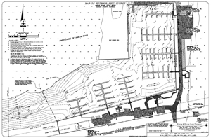 |
| |
|
|
Home | About Us | Scope of Service | Photo Gallery | Why a Survey? | Cost | Clients | Links | Employment Copyright ©2009 Manzie & Drake Land Surveying - All Rights Reserved | ||||||||||