

|

|

|

|

|

|

|
||||||
Subdivision Platting |
||||||||||||||||||||
Subdivision Plats are legal instruments intended to take a parcel of land and divide it into smaller parcels of land. These types of surveys must meet certain state regulations, county zoning regulations, local ordinances and other land use regulations and are recorded as part of the public records of that county. Reasons for Subdivision Platting: A Subdivision Plat is created when a landowner divides land into smaller parcels. As an example: If a landowner owns an acre of land and wants to divide it into three pieces, a surveyor would have to take precise measurements of the land and submit the survey to the governing body, which would then have to approve it. Another example of a subdivision applies when a landowner/building owner divides a multi-family building into multiple units. This is commonly known as a condominium. |
Examples: |
|
|
|
Click the following image for an example of a platted subdivision performed by Manzie & Drake Land Surveying. 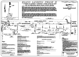 |
| |
|
|
Home | About Us | Scope of Service | Photo Gallery | Why a Survey? | Cost | Clients | Links | Employment Copyright ©2009 Manzie & Drake Land Surveying - All Rights Reserved | ||||||||||